Monday, May 31, 2010

Party Mode

The Taft Moose Lodge had a BBQ on Memorial Day for all members and their families. Carole's two sisters, Dee Ann and Mary Jane, came over from Bakersfield along with David, Dee Ann's husband, to spend the day with us at the Taft Moose Lodge BBQ.

Pictured below is Mike Floyd, Governor of the Taft Lodge, cooking tri-tip beef and chicken. I watched Mike closely and I'm satisfied he's done this before . . . the beef and chicken were both very good.


We filled our plates in the lodge along with chili beans, salads and desserts. We then had our choice of eating inside our outside in the picnic area. Since it was about 95 degrees outside, we elected to eat inside, but retired to the outside picnic area for more drinks and to listen to the music provided by a DJ.

We were in "Party Mode", so I wore my party shirt, my hat-with-hair and my patriotic necktie. Carole wore her big-brimmed straw hat. Aren't we cute?


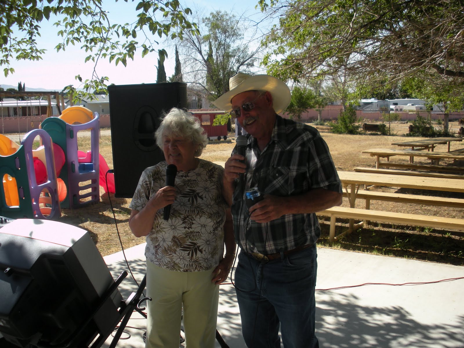
We had an enjoyable time partying with the Taft Moose families. They are all so nice and a lot of fun. Carole even got into singing karaoke with one of the members, although she admitted afterward she couldn't see the words on the TV screen. But she sounded pretty good.


This was to be our last night in Taft, so we said our goodbyes to David, Dee Ann, Mary Jane and all of the members of the Taft Moose Lodge. Tomorrow we will pull up stakes and head for Washington.

Friday, May 28, 2010

West Kern Oil Museum

As you might expect in a town located in the center of an oil area, they have an oil museum . . . the "West Kern Oil Museum". Of course, I had to check it out. Taft is located in Kern County, on the West side of the county, hence the "West Kern" title.


They had a number of buildings displaying all kinds of equipment used in the oil fields plus numerous displays of the history of oil exploration and development in the area.

One of the most interesting stories is that on March 15, 1910, at a depth of 2,225 feet, a well called Lakeview #1 blew in. Flowing at a rate of 18,000 barrels a day, it demolished the derrick, engine house and bunkhouses. Men worked around the clock building sandbag dikes while scrappers dug huge sumps to try to contain the oil so it would not flow into a large lake several miles away.

At it's peak, the flow reached 90,000 barrels a day and flowed uncontrolled for 544 days. This well produced 9 million barrels of oil, a record not yet matched by any other well in California.

Can you imagine what the environmentalists would do if this were to happen today?


In addition to the buildings with numerous exhibits and displays, there were many outdoor displays. They had a replica wooden derrick constructed on the property of the type which used to be used. Today, of course, the derricks are made of steel. But this historic wooden derrick was much larger and taller than I had thought they would be.


The outdoor displays included an old pumping system on the left below to pump oil to the refinery and an old wooden well pump structure on the right below.


Of course, trucks were used extensively in the oil fields. Many old trucks were on display, both inside the buildings and in the outdoor exhibits.


Kern County in Southern California produces nearly 60% of all the oil produced in California. The oil field around Taft, called the Midway Basin, produces 20% of all of the oil in California.

This museum was quite large and well arranged . . . quite an accomplishment for the small town of Taft. It was very interesting and educational. I strongly recommend a visit to the "West Kern Oil Museum" if you are in the area.

Thursday, May 27, 2010

Twenty-Five Hills

The Town of Taft is in the Southern California oil area. It seems as if everyone in town works in the oil fields.

South of town is an area called "Twenty-Five Hills". I suppose there are 25 hills there, but I had to drive through the area to take a look. The whole area is covered with oil wells, pump houses, compression stations, power distribution centers, and miles of pipes. Roads and trails appear to wind everywhere through the area so they can get trucks and equipment to all the wells.


Everywhere you look, there are miles and miles of pipes transporting the oil to collection stations where is is pumped on to distilling and refining plants in still larger pipes. Most of the pipes appear to be stainless steel.


I was totally fascinated with this concentration of oil wells and equipment. It's all a very strange sight for a boy raised in the Midwest.

I understand a Hollywood movie is to be filmed in this area soon and the name of the film will be "Twenty-Five Hills". Look for it a your local theatre.

Wednesday, May 26, 2010

The Jones Girls

We made the 30 minute drive from Taft to Bakersfield every day to spend some time with Carole's sisters. Her sister Dee Ann and her husband, David Graham, have a very nice home in the suburbs on the Western side of Bakersfield.


Pictured below are Carole, front and center, with her two sisters behind, Dee Ann Graham and Mary Jane Jones . . . all from the Jones Family. So I refer to them as "The Jones Girls".


We had a lot of nice days with Carole's sisters and, of course, enjoyed great meals as always. Shown below is David, Dee Ann's husband, who is great at his built-in BBQ grill in the back yard. Here he's grilling some beer brats . . . which were very good.


We went out to a Chinese Restaurant (Carole's favorite) and took our turns in the Graham's kitchen. Also while we were there, Carole's nephew, Matt O'Brien, drove up from San Diego. Carole hadn't seen Matt for many years, so it was nice they got to spend some time together.

Monday, May 24, 2010

Taft Moose Lodge

We wanted to be close to Bakersfield, California, where Carole's two sisters live, so we chose to park "The Bus" at the Moose Lodge in Taft, California, a town in the Southernmost part of the San Joaquin Valley.


We were the only RV parked at the Lodge and were parked beside their outdoor activities area, which included a BBQ area, lots of picnic tables, a couple of serving areas, and playground equipment for the kids.


The people of the Taft Moose Lodge are all so friendly. This will be a really good place to be parked for a week while Carole spends time with her sisters just 30 minutes from here.

Taft is located in an oil field area, so most of the residents work in the oil fields. Also there are lots of interesting things to see and explore around here, but more on that during the coming week.

Sunday, May 23, 2010

Waterford

The newlyweds, Cody and Melissa Rankin, left on their Honeymoon, Alek & Lexie flew back to Washington, and the other wedding guests, including Carole's two sisters left for home. We pulled up stakes and headed South to the Modesto area.

My brother, Ron, and his family had planned a get-to-gather at his daughter's house on Sunday, so we drove to John and Holly's (Ron's daughter and son-in-law) and parked "The Bus" in the farm yard adjacent to their house in Waterford, California. Their house sets among the Almond Orchards, a really nice place for us to park.


We enjoyed a nice BBQ dinner and lots of conversation with Ron, his kids, his grandchildren and his great-grandchildren. Holly is shown on the left below in her kitchen preparing a dinner. John is shown on the right below looking out his living room window checking on wildlife in the almond orchard.


We enjoyed the family, John & Holly's hospitality, and the location so much, we ended up staying a little over a week. It was a very relaxing time and place . . . and, of course, the food was great too.

Saturday, May 15, 2010

Mr & Mrs Rankin

Cody and Melissa said their marriage vows today . . . and they are now "Mr & Mrs Rankin! What a beautiful setting.


The bride was glowing! Her gown was fabulous. This was her day.


Carole's grandson, Alek Krallman, and his girlfriend, Lexie, flew in from Washington for the ceremony and festivities. Alex and Melissa had not seen each other for some time, so this was also a cousin's reunion.


Following the ceremony, we enjoyed a nice dinner in an area by the Winery Tasting Room where we had set up tables the day before. Then on an intermediate area below the Winery Tasting Room, a DJ set up and began playing music. Carole, to get the party started, donned the bride's veil and we started the dancing.


As the evening wore on, the music got louder and faster. All of the young crowd joined right in. However, when the dancing began to take on the appearance of a 'tribal ceremony', Carole and I said goodnight and returned down the mountain to "The Bus" leaving "Mr & Mrs Rankin" and their guests to enjoy the rest of the night.


"Mr & Mrs Rankin" . . . Congratulations!

Friday, May 14, 2010

Practice Makes Perfect

I suppose weddings are like anything else . . . "Practice Makes Perfect". So on Friday before Melissa and Cody's wedding, the wedding party gathered at the Sierra Knolls Winery, which will be the location of the wedding.


We all pitched in to set up tables and chairs for the wedding, and then the wedding practice began. Most of the wedding group ran through their paces quite well in preparation for tomorrow. A few stumbled through the practice session, but hopefully, "Practice Makes Perfect".

This winery is a great place for a wedding. Downhill from the Winery Tasting Room is a large concrete patio with a wrought iron gazebo overlooking the valley in the Sierra foothills. The wedding ceremony will be held in the gazebo. Chairs for guests were set up on the patio. A beautiful location.


The view back uphill from the gazebo to the Winery was very nice. Most of the grounds were terraced and well landscaped with lots of flowers in bloom.


Melissa's immediate family is shown below following the practice session. Left to right is Melissa's mother, Cary Sharp; Melissa's paternal grandmother, Carole; Melissa; and Melissa's maternal grandmother, Dixie Flynn.


The weather was great, the view from the Winery was spectacular, and the owners were very pleasant. I hope everything goes well tomorrow, which it probably will since"Practice Makes Perfect". Besides, we can get into some serious wine tasting tomorrow.

Thursday, May 13, 2010

Auburn Gold Country RV Park

The "Auburn Gold Country RV Park", where we are staying in Auburn, California, is a small park, but very pretty. Every site has a paved pad on which to park and the paved area is wide enough to provide a large patio beside "The Bus". All of the grounds of the park are very well landscaped with nice shade trees everywhere.


We are situated in the foothills of the Sierra Mountains, so the nights may be cool, but the daytime weather is beautiful. The winery where the wedding will be is about 25-30 minutes from here in a remote area further up into the foothills. We'll see that tomorrow.

Wednesday, May 12, 2010

Last Leg

The trip across Western Nevada was a very flat ride through miles of desert. The sky was partly cloudy, but with big white puffy clouds, and the temperature was in the high 60's. There had been (or is going to be) road construction on many, many miles of I-80 as there were orange and white barrels lining the inside of the road way for a very long way. Wouldn't it be nice to be in the barrel rental business?


We rolled through Nevada into Reno, and then into California. As we began to climb toward Donner Pass, we began to see snow on the sides of the hills and along the roadway, but the sky was clear and there was no precipitation in the forecast . . . thank God. The roadway was clear and dry.


The drive through Donner Pass and across the Sierra Mountains of Northern California is a very scenic trip.


As we began to come down out of the mountains, we were watching the elevation signs . . . 5,000 feet, 4,000 feet, 3,000 feet, and then we pulled into Auburn, California, at a little over 2,000 feet elevation where we plan to stay for four nights. We came to attend the wedding of Carole's granddaughter at a nearby winery in the foothills.

. . . and so ended the "Last Leg" of our cross-country journey to California.

Tuesday, May 11, 2010

Snow in the Pass

The morning weather report was again forecasting snow in the higher elevations ahead of us. We were facing three passes above five thousand feet and the sky looked threatening as we headed West on I-80 from Westover, Nevada.


The road was making a gradual climb and before long, we were seeing some snow along the side of the road, but the road was just wet. The further we drove, the more snow we saw.


As we approached the grade up to our first pass, the yellow warning signs at the side of the road were flashing. Chains were required! Trucks were pulling off at the chain-up area. We did too.

We sat there for about 30 minutes watching it snow. None of the trucks were putting on chains, and some of them began to go ahead without chains. I decided that they had communication with other truckers and had learned that they could go over the pass without chains. So we followed.

Our pace was only about 20-25 MPH with the snow coming down harder. Our windshield and the windshield wipers began to ice up. It was hard to see the tire tracks of the trucks ahead of us.


But we made it up the grade, through the pass, and started down the other side. As we reached lower altitudes, the ice began to blow off of our windshield. We could see again.

It stopped snowing and the road cleared up. We still had a little mist, but I was glad to be out of the snow.


The road flattened out again as we approached Lovestock, Nevada, where we decided to stop for the night.


I wonder what we would have faced on US50 with it's steep grades and numerous switchbacks.
I'm sure glad we did not take "The Loneliest Road in the World". God was watching out for us.


Even the cloudy sky looked beautiful!

Monday, May 10, 2010

The Loneliest Road in the World

We had to take time out this morning to add coolant to the engine of "The Bus" as we had trouble keeping the engine cool going up some of the grades crossing the Colorado Rockies. Then while talking with local people in Salina, Utah, we learned that US50 across Nevada is known as "The Loneliest Road in the World". Then I heard the weather report forecasting snow at the higher elevations.

I began feeling a little uneasy about traveling "The Loneliest Road in the World". We were told that we faced hundreds of miles of open desert between towns, steep grades in the mountains and many switchbacks. What if we had a breakdown? What if we got caught in a snow storm?

We left Salina, Utah, and had to travel a short distance on the Interstate before we got to the US50 exit to take the scenic route . . . known as "The Loneliest Road in the World". I missed the turnoff and we had to travel nearly 20 miles before we had an opportunity to turn around. I decided God was trying to tell me something . . . like we should not take "The Loneliest Road in the World". So I decided to stay on the Interstate.

The weather was bright and sunny. The temperature was very pleasant. We connected with I-80 Interstate, the easy route, which would take us across Nevada and all of the way to California. The road was quite flat through the Salt Evaporation Area of Utah and desert area of Nevada. It was really kind of a boring drive.


We had a rather uneventful day and when we stopped for the night in Westover, Nevada, I began to wonder if my concern about traveling "The Loneliest Road in the World" had been an over-reaction.

Sunday, May 9, 2010

An Easy Day of Travel

We left Montrose, Colorado, this morning under overcast skies, but the sun peeked through from time to time and the temperature was in the 60's. The early part of today's route took us in a Northerly direction where US50 meets up with I-70.


We drove across fairly flat land until we approached the Grand Junction area where we began to see some rugged territory.


At Grand Junction, we had to join I-70 and follow the Interstate Westerly to Salina, Utah, where US50 leaves the Interstate and continues on West. At least tomorrow we can leave the Interstate and get back on the more interesting scenic route.


The scenery was very nice along the Interstate, but we stopped in Salina for the night. Today has been "An Easy Day of Travel", but it's been a long day.

Happy Mother's Day

To all of you Mothers out there . . .

Happy Mother's Day!

Saturday, May 8, 2010

Colorful Colorado

We had stopped Friday night at an RV Park in Pueblo, Colorado, and awoke Saturday morning to bright sunshine and our first glimpse of the Rocky Mountains with snow still on some of the taller peaks.


From Pueblo, we followed US50 along the Arkansas River which provided us with some great scenery. Much of this section of the Arkansas River has a lot of white water rafting and we were able to see many of the groups as they made their way downstream. It was a Saturday and there were a lot of rafts on the river.

We also witnessed a very large number of fly fishermen all along the river. It must be trout season. I thought about stopping and getting out my fly rod, but didn't feel I should take the time. But, what a temptation!


We eventually ran out of river and made our way up the grade and across the Continental Divide at 11,200 feet. There we found ourselves in snow, although the road was clear and dry.


Carole wasn't very happy about US50 winding around at 11,000 feet, but I thought it was an absolutely amazing drive. We made our way through most of the Colorado Rockies and stopped Saturday night at Montrose, Colorado, a very pretty small mountain town which obviously caters to outdoor enthusiasts; skiers, bikers, hikers, rafters, fishermen, and hunters.

What a wonderful day. I can hardly wait for tomorrow.